
File:"Political South America" CIA World Factbook.svg

Size of this PNG preview of this SVG file: 454 × 599 pixels. Other resolutions: 182 × 240 pixels | 363 × 480 pixels | 582 × 768 pixels | 776 × 1,024 pixels | 1,551 × 2,048 pixels | 631 × 833 pixels.
Original file (SVG file, nominally 631 × 833 pixels, file size: 5.73 MB)
| This is a file from the Wikimedia Commons. Information from its description page there is shown below. Commons is a freely licensed media file repository. You can help. |
| Description |
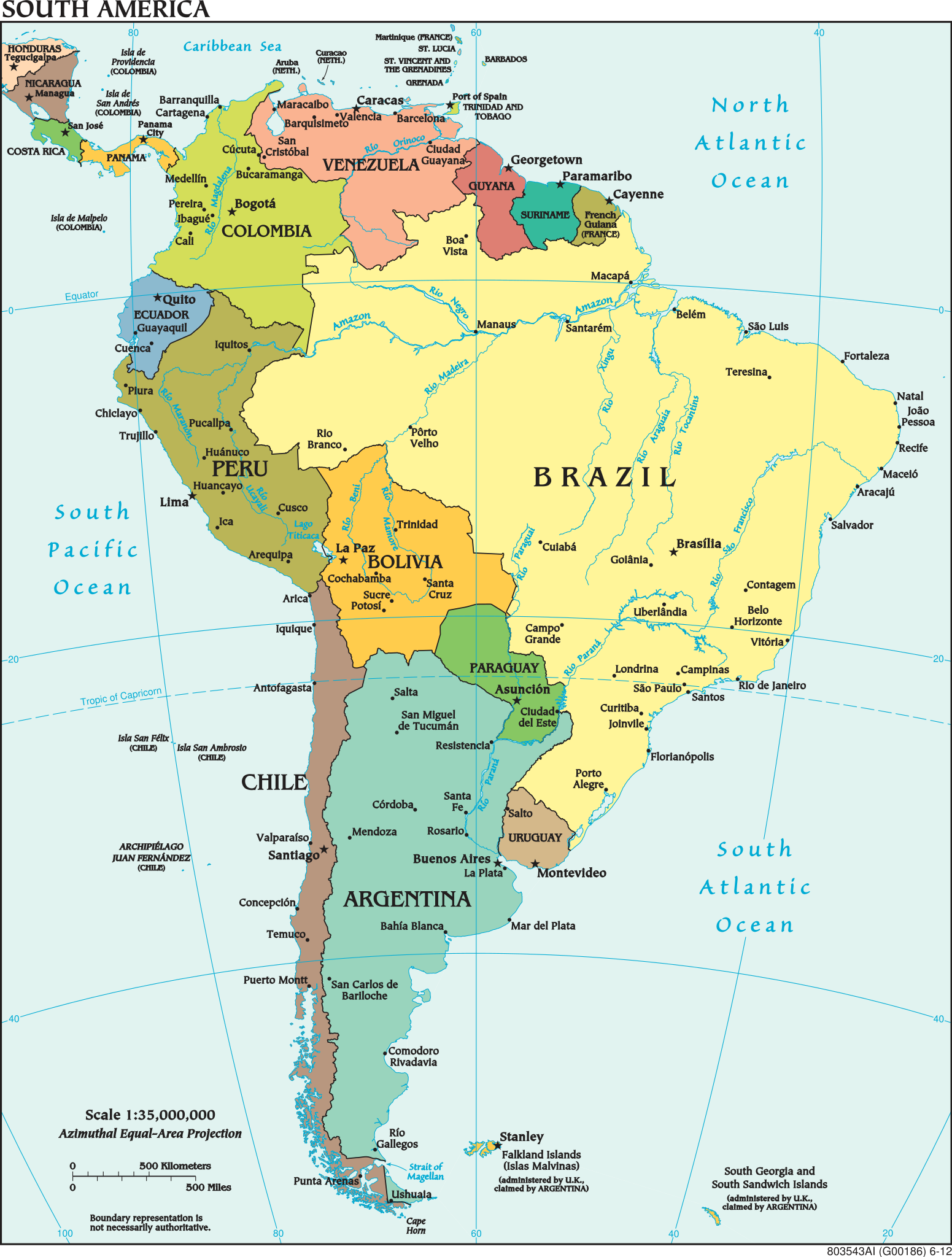
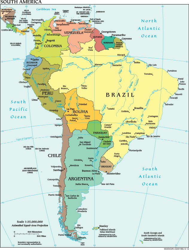
English: Political map of South America.
Deutsch: Politische Karte von Südamerika. |
|||
| Date | accessed 30 September 2015 | |||
| Source | https://www.cia.gov/library/publications/the-world-factbook/docs/refmaps.html converted from PDF using pdftocairo | |||
| Author | United States w:Central Intelligence Agency | |||
| Permission (Reusing this file) |
|
|||
| Other versions |
 |
|||
| SVG development |

File history
Click on a date/time to view the file as it appeared at that time.
| Date/Time | Thumbnail | Dimensions | User | Comment | |
|---|---|---|---|---|---|
| current | 12:47, 30 September 2015 | | 631 × 833 (5.73 MB) | Hairy Dude | resize image to fit contents (eliminate the margin) |
| 12:42, 30 September 2015 |  | 765 × 990 (7.56 MB) | Hairy Dude | {{Information |Description ={{en|1=Political map of South America.}} {{de|1=Politische Karte von Südamerika.}} |Source =https://www.cia.gov/library/publications/the-world-factbook/docs/refmaps.html |Author =United States [[:w:Centra... |
File usage
No pages on the English Wikipedia use this file (pages on other projects are not listed).
Global file usage
The following other wikis use this file:
- Usage on bs.wikipedia.org
- Usage on fi.wikipedia.org
- Usage on it.wikipedia.org
- Usage on lg.wikipedia.org
- Usage on lld.wikipedia.org
- Usage on st.wikipedia.org